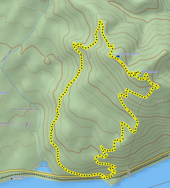
The looping trail - 7.2 miles

Elevation Profile
| Hiking up Dog Mountain and Wind Mountain, Sept., 2010 |
Click on the small pictures to see larger ones. |
| Dog Mountain |
| We had some rainy days in Portland, so I thought I'd check out the wildflowers in the meadow on top of Dog Mountain, and boy, were they great! Even on the 2nd of September, which is very late for wildflowers, they were worth the hike. |
|
The looping trail - 7.2 miles |
Elevation Profile |
|
The day was warm, with a strong wind blowing in from Eastern Oregon, warming things up very nicely. I did a loop-hike, using Augsberger Mountain's trail as my ascent, since it is less steep than Dog Mountain's trail. I'm glad I did, because the hike was shaded, being on the west side of Dog Mtn. |

spider web almost caught me |
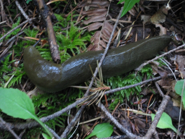
SLUG! |
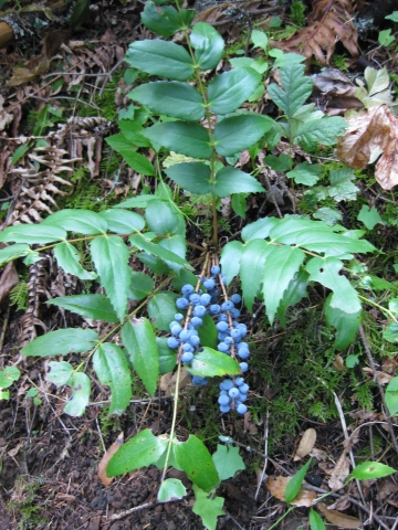
huckleberries? |

pretty trail beckons me |
|
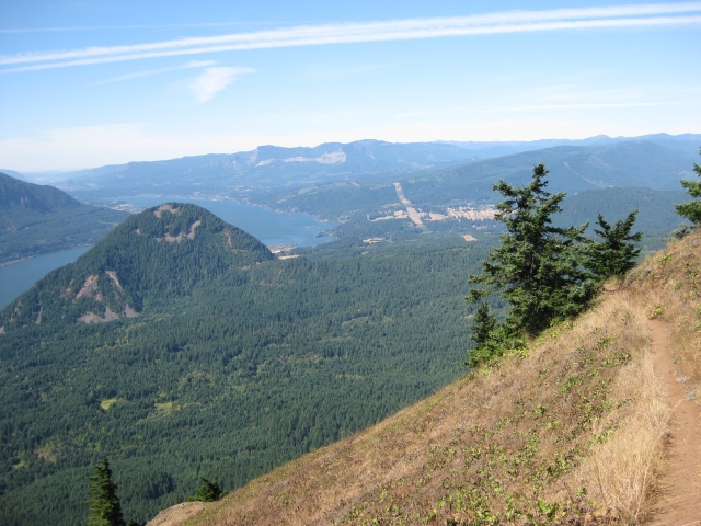
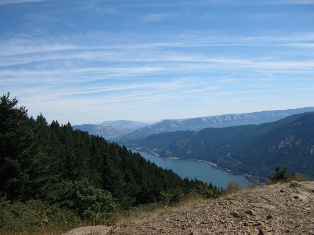
Judging by the number of unbroken spiderwebs across the trail, I think I was the first to hike that path today. It was neat, so nice and cool in the woods. The trail was fairly steep, but in good condition and I enjoyed the peek-a-boo views of Wind Mountain as I ascended. Soon, though, I took a left-hand turn and was greatly rewarded for my work. What a terrific alpine meadow! And clear, sweeping views of the Gorge, both east and west. I could even see the high desert far off to the east. |

Wind Mountain watches me |

cheerful flowers |
steep meadow! |

more flowers, yay! |
It was a great place to have lunch and try to identify the mountains around me that I had already climbed. I could see Mt. Hamilton and Beacon Rock in the distance. Across the water was Mt. Defiance, which I haven't climbed yet. And to the west across a small valley was Wind Mountain, on my list for the next day...stay tuned! |

mind the dropoff... |

see Mt. Hood peeking over the ridge? |

looking west |
desert to the east |
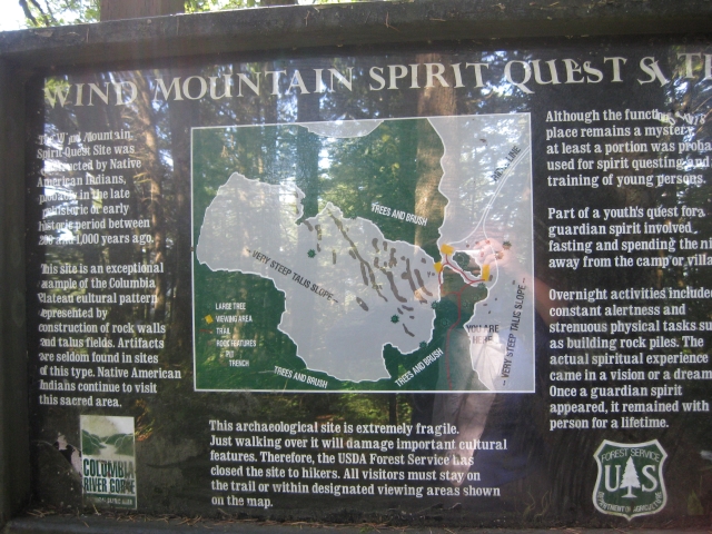
| Wind Mountain |
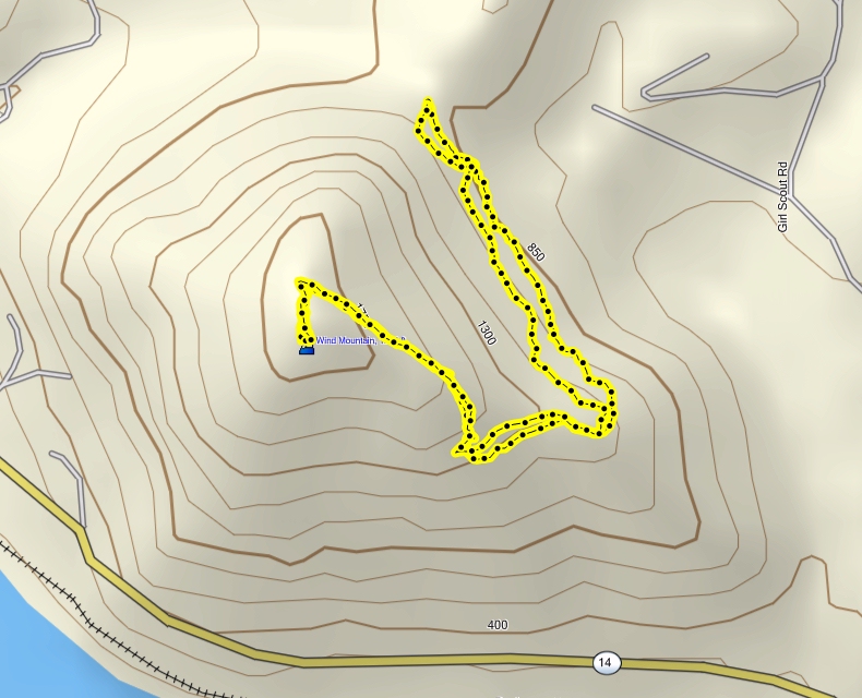
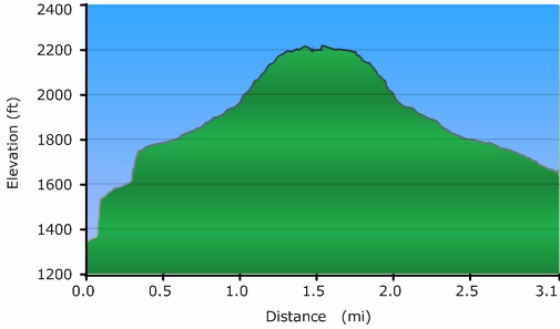
The trail - 2.5 miles (approx.) |

Elevation Profile |
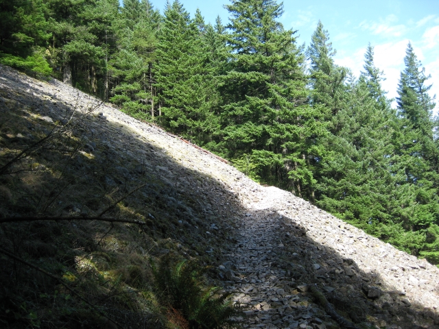
| The trail up Wind Mountain is rough in places and steep everywhere. The trail gains over 1200 feet in just about a mile. It's well worth it, though, to experience the deep, quiet woods along the way and the wind-swept ridge at the top. There are native American vision quest sites, called 'talus sites', there and several signs warn about not disturbing them. Although there are no artifacts, the sites are considered archeologically significant, and besides that, they are sacred to the native tribes who created them. |
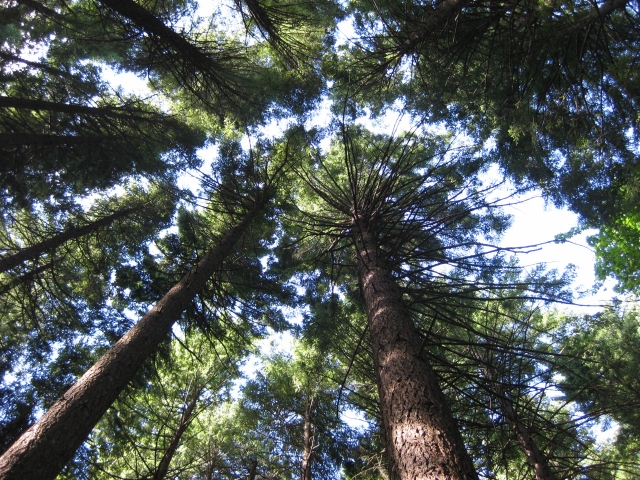
neat canopy, quiet woods |

rare level trail section |
tricky footing, and a long way down if you slip |
sign about the sites |
|
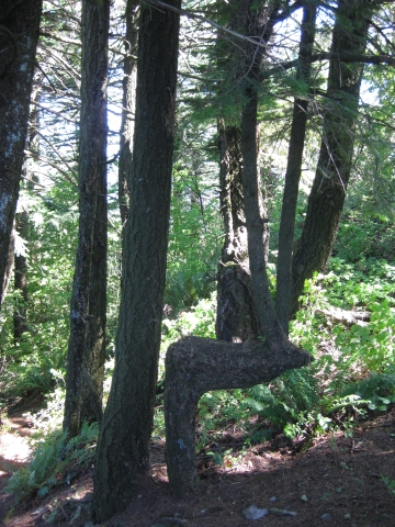
I was raised to respect these sites and I did. But I also really enjoyed sitting on a tree trunk that, for some reason, grew sideways along
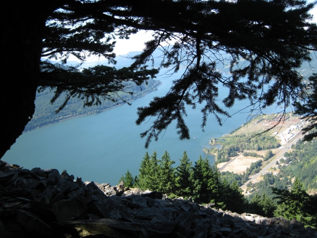
one of the talus fields and looking down at the valley, both to the east and to the west. It was very quiet up there, despite the wind.
That's probably because this hike, while official and sanctioned by the Forest Service, is not generally included in hiking books. I found
it as a footnote in one of my books and looked on the internet for more information. Unless you're standing there, it's hard to see where the talus sites are. Basically, they're nests of stacked rocks built into the huge rock fields that surround the ridge of Wind Mountain. The rock fields are scary and steep. The rocks are loose, and in places, it looks like if you slip, you will fall right off the face of the mountain, with nothing to stop you until you hit the valley floor. |
westward view from above a site |
interesting formation |

looking east from a site |

that's Dog Mountain over there |
| I had an interesting encounter with a very big female deer on the mountain top, but other than that, I had the ridge to myself. I walked around a while, looking at the sites, and then headed down the mountain. On the way down, I passed a woman with three dogs. One of the dogs trotted past me just fine, but the other two stopped in their tracks, turned tail, and literally ran past the woman back down the trail. I don't know what spooked them, and neither did she. Eventually, I had to turn my back to them and take a few steps off the trail so that she could drag them past me by their collars. It was wierd. |
| Lower Falls Creek Falls |

The trail - 3.4 miles |
Elevation Profile |
| Hiking to the waterfalls on Falls Creek was a special treat that I added on a whim to round out the day. I found it in a hiking book and realized it was just a few miles away from Wind Mountain. It turned out to be more like 20 miles away, but the drive through the Gifford-Pinchot National Forest was worth it. |

serene woods |
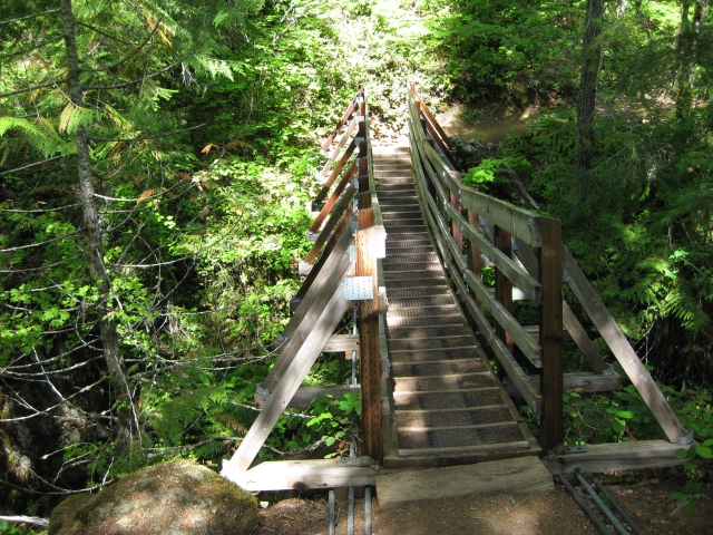
neat swaying bridge |

Falls Creek |

a woodpecker buffet! |
| It's a short, easy 1.7-mile trek to the falls and they're definitely worth the effort! The top of the falls is what I call 'champagne fountain' style, where the water cascades down onto boulders, pools, then overflows onto the next set of rocks, and repeats until the water is all spread out like a fountain at a wedding reception. But the bottom of the falls is a 'pounder', where the water recollects and then shoots through a narrow opening, slamming down into the pool below with tremendous force. It's a great combination of nice, gentle peaceful falls, and feel-it-in-your-chest, misty air, powerful falls. I had a great lunch there and was reluctant to leave. The day was hot, but by the falls, the mist kept me cool. |

the falls peeking at me through the trees |
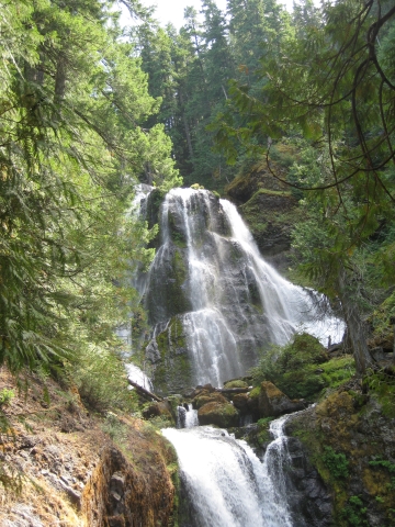
the top: 'champagne fountain' style |
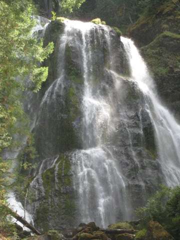
close-up of the top |
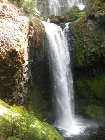
the bottom of the falls very loud! |
|