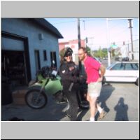
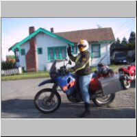
We rode to the border and crossed at Sumas, WA. The customs officer asked quite a few questions, but finally let us through. We rode to Mission, then on to Kilby where we tried to stay at the Provincial Park, but it was full so we stayed at a private campground on a lake. The trout were jumping and we had quite a time watching them. The weather was warm, despite the grim forecast.
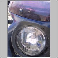
The next morning, we rode into Hope and had breakfast. Hope, in case you didn't know, is the "Chainsaw Carving Capital" and has giant carvings on every street corner. It's a great little town. After fueling up, we hit the road for Lytton, where we rode up the Fraser Canyon road (highway 12) to Lillooet. It was at a pit stop that I noticed this really pretty blue moth that I had somehow hit with my bike along the way. Notice how its wings are exactly the color of my KTM. Do you suppose it thought I was the mothership?
We rode on to Williams Lake and turned west on highway 20, which would eventually take us to the coast. We camped at Bull Canyon Provincial Park that night, which is right by a big, slow-moving river. It was very peaceful and still the weather was great! On Sunday, we rode into Anahim Lake, where we checked into a cabin on the lake.

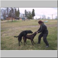
The folks who run the lodge are very friendly and I highly recommend staying here if you ever get the chance. You can fly right into Anahim and they will pick you up at the little airport and bring you back. Each cabin has two double beds, a wood stove, sink, propane stove, dishes, screened-in porch, and little refrigerator. There are showers and nice restrooms in a separate building. As we pulled up, three dogs came to greet us. One was a little wire-haired terrier named "Duffer" and the other two we quickly named "Humper" and "Humpy". See if you can guess why! They were very friendly and I enjoyed throwing their sticks into the lake for them.
We left our gear in the cabin and took off down "The Hill", as the locals call the road to Bella Coola. Anahim Lake is the end of the pavement so we were soon into the off-road mode and very excited to achieve our goal! As you can see, the weather forecast was catching up to us and it rained most of the way down The Hill.
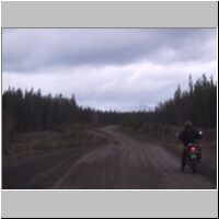
Highway 20 is known as the "Freedom Highway", because it allowed folks to drive out of Bella Coola without having to take the ferry. Actually, the Ministry of Highways had decided that the road couldn't be built at all, so the residents of Bella Coola and Chilcotin built it themselves! Freedom, indeed!
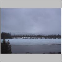
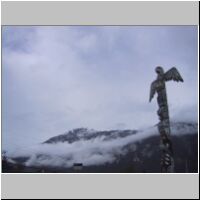
We wandered around Bella Coola while the surrounding mountains peeked at us through low-hanging clouds. The native word for the village is renowned as being the longest single-word name for a town in the world. I was disappointed that the Visitor's Center/Museum was closed, since I wanted to hear someone pronounce that name!
The rain stopped while visited Bella Coola and didn't start again as we prepared to ascend the daunting 18% grades back over the pass. But our bikes did a great job and I think maybe this time Lin didn't have to wait too long for me back at the pavement!
There is a restaurant at Anahim Lake called "The Dutchman" and after having a quick cider at the lodge, we decided to eat out. I promise that our decision to eat out that night was in no way influenced by the fact that the volunteer fire department was also eating there :)
We had a great night sitting on the dock, listening to the loons and sipping scotch. What a peaceful wonderful place that was. The host showed us through his binoculars that you can see five separate mountain ranges from right there in the lodge. The next morning, we slept in and sat on the porch drinking coffee and tea and watching the birds.
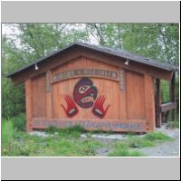
On Monday morning, we bid a fond farewell to our hosts at Anahim Lake and started to make our way back east. On the way, a bag flew off the back of my bike but it was 65 miles before I noticed. Luckily, it didn't contain anything terribly important (like my rain gear or tent poles) but Lin was patient and waited while I drove back to look for it. I didn't find it. The weather turned on us that afternoon, too, with rains and strong winds. But it soon cleared up and we were off the pavement again at Hanceville, bound for Gang Ranch.
We got fairly lost on the dirt roads out by Big Creek and unfortunately Lin's shift-lever broke out there so she couldn't shift gears. But we found a little logging camp called Gascard Camp and the folks there helped us out. An older man and his son were very friendly. The son gave me his map and showed us how to get to Gang Ranch while the man loaned Lin his Vise-Grips and she clamped them onto her shift-shaft as a makeshift lever. It seemed to work, so off we went!
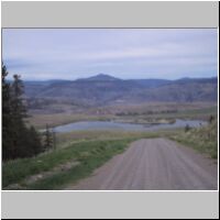
It was a long ride but the scenery as we descended into Gang Ranch was terrific and well worth it. We crossed over the river on a cool suspension bridge and rode 30-40 more miles before stopping for the night at Beaver Dam Forest Park. The road was twisty and pretty hairy in places, with a sheer dropoff on the right. Down one tight corner, we could see four or five wrecks of cars that had failed to make the turn. We were very careful!
We stopped in a little town for breakfast and couldn't resist an antique "emporium" but we really struck gold, finding several rolls of mid-70's motorcycle wallpaper for fifty cents! We immediately took it to the post office and mailed it back home, knowing that such treasure would never survive the remaining two days of travel. It's lucky that the wallpaper was so cheap, because mailing it was not!
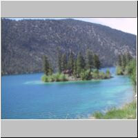
On Tuesday, we rode back to Lilloet, stopping along the way to snap pictures of the extraordinary mineral coloring in this lake (I think it's called Marble Lake) and visited the Forest Service where we bought some more maps and found out about a dirt road that followed the Fraser Canyon back south to Lytton, on the opposite side than where we rode up a few days earlier. The road was marked "very rough" but wasn't too bad. More cliff-hanging turns and piles of rocks, along with some blind hills and corners, and unpredictable pockets of sand. There were cows and horses in the road, too, so we learned not to go too fast! It was a great ride, and at the end of it there was a little three-car ferry that took us across the Fraser River back to Lytton. We camped just north of there at Skihist Provincial Park, for our last night out.

On Wednesday morning, we took our time and rode down to Hope for breakfast again. Then we passed back through Customs and hit the slab (I-5) for Seattle.
It was a terrific trip, despite our minor complications. We had a great time exploring B.C. and everyone we met was so friendly! Every time I travel in Canada, I am struck by the kindness of the locals, and their willingness to share their beautiful province with us. So many people stopped to talk to us about our bikes, our destination, our chosen routes, and wished us a safe trip! Even the policeman stopped to help us when we were pondering a couple of lost bolts on Lin's bike. He directed us to a local repair shop, and they were (of course) more than happy to give Lin a sampling of nuts and bolts to try. In no time at all, we were back on the road! I am looking forward to many more trips in B.C.!
 site maintained by Cheryl